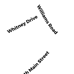
130 WILLIAMS RD
Owner Information
RAFUS WILLIAM S
130 WILLIAMS RD
ASHBURNHAM, MA 01430


Property Details
130 WILLIAMS RD is classified as a Single Family Residential (Cape cod).
The primary structure on this property was built in 1920. There are 1,874ft2 of built area within this property. There is 1,082ft2 of residential/living space within this property. This property is listed as having 6 rooms.
130 WILLIAMS RD is valued at $184,100. The land is valued at $39,200 and the structures are valued at $133,700. There is an additional valuation of $11,200 on this property.
This property is in Zone RA. Confirm with local Zoning Board authorities to ensure there are no overlays or other easements on this property.
The most recent deed for 130 WILLIAMS RD is recorded at the local registrar in Book 8066, Page 0231. 130 WILLIAMS RD was last sold on Monday, January 13, 2014 for $139,900.
Assessment data from fiscal year 2022.
Flood Data
According to the FEMA National Flood Hazard Layer, this property does not appear to be in a flood zone. It may also be in an area not yet reviewed. Nonetheless, confirm this information prior to taking any action.
To view the flood hazards around this property, create a FEMA "Firmette" Map of the area around 130 WILLIAMS RD.
Broadband Internet Providers
| Provider | Type | Bandwidth (mbps) | |
|---|---|---|---|
| Viasat Inc | Satellite | 100 | 3 |
| Comcast | Cable | 1000 | 35 |
| VSAT Systems, LLC. | Satellite | 2 | 1 |
| HughesNet | Satellite | 25 | 3 |
| GCI Communication Corp. | Satellite | 0 | 0 |
| PAETEC Communications, Inc | Fiber | 0 | 0 |
| Verizon New England Inc. | DSL | 15 | 1 |
Broadband service provider data from December 2020.
Adjacent Properties
- 136 WILLIAMS RD
Single Family Residential owned by BOSHANS WILLIAM L & LOIS M L/E - 32 WHITNEY DR
Single Family Residential owned by SWEDBERG JOYCE R - 36 WHITNEY DR
Single Family Residential owned by NEAL CASEY T - 132 WILLIAMS RD
Vet Organization owned by AMERICAN LEGION - 40 WHITNEY DRIVE
Single Family Residential owned by ELLSWORTH BRIAN G - 38 WHITNEY DRIVE
Single Family Residential owned by LOUGHLIN STEPHEN - 124 WILLIAMS RD
Single Family Residential owned by MARTINEAU CHERYL ANN